Erosion By Rivers. Continued
Description
This section is from the book "An Introduction To Geology", by William B. Scott. Also available from Amazon: An Introduction to Geology.
Erosion By Rivers. Continued
Unless the region through which a river flows is upheaved, and thus, by increasing the fall, renewed power is given to the stream, a stage must sooner or later be reached when the vertical cutting of the stream must cease. This stage is called the base-level of erosion, or regimen of the river, and it approximates a parabolic curve, rising, toward the head of the stream. Elevation of the country will start the work afresh, until a new base-level is reached, while depression will have a contrary effect and may put a stop to vertical erosion where it was in active progress before. When the base-level is reached, the river cuts laterally, undermining its banks (see Fig. 55) and working like a horizontal tool upon the country-side.
Fig. 55. - Undermined pot-hole, Little Falls, N.Y. The arrow points to the upper opening and the partly concealed figure stands in the lower part. (Photograph by van Ingen).

Fig. 56. - Pot-hole in stream, Mill Creek, Oklahoma. (U. S. G. S).
As valleys are also excavated by other agents, it is important to note the characteristic features of river-formed valleys. Unassisted by other agencies, a river cuts a narrow, steep-sided trench or gorge, the possible depth of which depends upon the height above base-level at which the river began its work, disregarding any subsequent elevation of the land. As soon as the gorge begins to form, its sides are attacked by the- atmospheric destructive forces and a process of widening is begun; but this is very slow and to widen out the gorge or canon into a broad valley, with gentle slopes, requires a very long period of time, determined by the activity of the climate and the resistant power of the rocks. Even in the gorge stage, a river valley tends to have a V-shaped cross-section, because the upper part of the gorge, having been longest exposed to weathering, has suffered the greatest loss.
A river valley is rarely straight for any considerable distance, but takes a sinuous course, with rocky spurs projecting alternately from opposite sides of the stream, and these spurs have a continuous (or a terraced) slope from top to bottom. This is true even of swift streams flowing through hard rocks, and the tendency is much exaggerated when the velocity of the current is diminished and the river-bed is in soft materials, as in the lower Mississippi. Under such conditions the stream meanders to an extraordinary degree and often, by cutting through the narrow neck of a meander, abandons part of its channel and leaves an "ox-bow lake" to mark its former course.
Still another feature of river valleys is the accordant relation between the main valley and its tributaries. Normally, the tributaries lower their beds at the same rate as the main stream and enter the latter on the same level. Exceptions to this rule do occur, as in the case of the tributaries below a great cataract in the trunk river, which enter high up on the gorge walls, but such exceptions admit of a ready explanation.
When a river enters the sea or a lake, its velocity is checked and it is no longer able to excavate a channel, so that the continuation of the river channel across the sea-floor, like that of the Hudson (see p. 34), is a proof that the lower course of the stream has been submerged under the sea. There are, however, two known instances of the excavation of a jiream channel in the bed of a lake, the upper Rhone in Lake Geneva and the upper Rhine in Lake Constance. These streams are both glacial streams of very cold and dense water and charged with great loads of coarse sediments. Discharging into bodies of warmer and lighter water, the river currents are able to maintain themselves for some distance from shore and thus to cut trenches. Other examples will, no doubt, be found under similar conditions, but must be very uncommon.

Fig. 57. - A meandering stream; ox-bow lakes of the right: Alashuk River, Alaska. (U. S. G. S).
Having learned the general character of river erosion, we may illustrate it with a few concrete examples.
1. A particularly interesting case is that of the little river Sitneto in Sicily, since the history of its gorge is so well known. In 1603 a great lava flood from Aetna was poured out across the course of the stream, a.nd, when cold, solidified into a barrier of the hardest rock. When Sir Charles Lyell visited the spot in 1828, he found that in a little more than two centuries the stream had cut a gorge through this barrier of 40 to 50 feet deep, and varying in width from 50 to several hundred feet. The lava which had thus been trenched is not porous or slaggy, but homogeneous, dense, and very hard.

Fig. 58. - The Au Sable Chasm, N.Y. (Copyright by S. R. Stoddard, Glens Falls, N.Y).
2. In the northern parts of the United States the great ice-sheet, which in late geological times covered the country, brought down with it vast quantities of drift, that filled up the channels of many streams and quite revolutionized the drainage of certain districts. Since that time the displaced streams have cut out new channels for themselves, often through hard rocks, and many now flow in quite deep gorges, with nearly vertical walls. Au Sable Chasm, New York, is an example of these geologically modern river gorges, the atmosphere not having had time to widen it. 3. The Niagara is an exceptional case, the gorge being cut, not only by the direct abrasion of the running water, but also by the action of the spray and frost at the falls. In the ravine the upper rock is a hard, massive limestone, which is underlaid by a soft clay shale. The latter is continually disintegrated by the spray of the cataract and by the severe winter frosts undermining the limestone, which, when no longer able to bear its own weight, breaks off in tabular masses.
Thus the falls are steadily receding, leaving behind them a gorge, which is deepened by the river and especially by the plunging masses of water at the foot of the cataract.
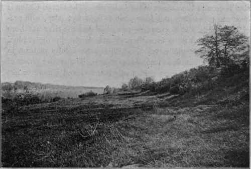
Fig. 59. - Old, high-level channel of the Niagara River, below the present falls.
(U. S. G. S).
4. One of the most remarkable known examples of river erosion is seen in the canons of the Colorado. The Grand Canon is over 200 miles long and from 4000 to 6500 feet deep, with precipitous walls. It is extremely probable that the river has been rendered able to cut to such profound depths by the gradual uplifting of the whole region, which is now a lofty plateau, in places more than 8000 feet above the sea. The erosive power of the river has thus been continually renewed and a more or less uniform rate of excavation secured.
5. Finally, an extremely curious example of river erosion is the gorge of the Zambesi River in South Africa, at and below the Victoria Falls. Above the falls the river is more than a mile wide, and at the cataract it plunges into a narrow chasm which is transverse to the course of the river. From the chasm the only outlet is by a narrow gorge of only 50-60 yards in width,- and below this gateway the gorge continues for many miles in a series of sharp zigzags, which are highly exceptional in such a hard rock as the basaltic lava which the river has trenched to a depth of 400 feet. This remarkable result is due to the fact that the excavating work of the river has been controlled by the lines of joints in the rock.
Transportation By Rivers
The main importance of rivers as geological agents is not so much their work of erosion, but lies rather in what they accomplish as carriers of the results of their own destructive activity and that of the atmosphere, comprising both the materials which are mechanically swept along in suspension and those which are carried in solution.
Continue to:
My Books

