Part III. Geo Morphology. Chapter XVIII. The Geographical Cycle
Description
This section is from the book "An Introduction To Geology", by William B. Scott. Also available from Amazon: An Introduction to Geology.
Part III. Geo Morphology. Chapter XVIII. The Geographical Cycle
Geomorphology, or physiography, is the study of the topographical features of the earth, and of the means by which, and the manner in which, they have been produced. In this country the term physiography, or physiographical geology, is firmly established and very widely used. This is unfortunate, because the term was originally proposed and still continues to be employed in a very different sense. It would be an advantage in clearness and precision of nomenclature, if Geomorphogeny, which is extensively made use of in Germany, could be substituted.
This subject is primarily a department of physical geography, but is of value to the geologist for the light which it throws upon the historical development of the land surfaces, and upon features of the past which are not recorded in the processes of sedimentation. The geographer endeavours to explain the topographical forms of the land, and, in order to do this, he must show how those forms have originated. The geologist, on the other hand, makes use of the topography to determine what changes have passed over the land, and in what order those changes have occurred. The old method of reading geological history concerned itself merely with the sedimentary accumulations and igneous intrusions. This method has the defect of leaving us without information regarding the changes of land surfaces (except where transgressions of the sea are recorded in unconformities) and the details of mountain-making. The physiographical method supplements this by adding, in part, the required information concerning the land surfaces.
Each method is improved and strengthened when we use both of them together, and when we are able to correlate the accumulations of sediments with the denuding processes which furnished the material.
The topography of any land area may be considered as the outcome of a struggle between two opposing sets of agencies: (1) those which tend to upheave the region and thus increase its elevation; (2) those which tend to cut down the land in one place and build it up in another. The latter comprise the agencies of degradation and aggradation respectively, while the former are the diastrophic agencies.
The details of topography are, in large degree, controlled by still a third class of factors, which, however, are passive rather than active; namely, the character, arrangement, and attitude of the rock masses. A partially degraded region in which the rocks are homogeneous will have a very different kind of relief from one in which the rocks are heterogeneous and differ materially in their powers of resistance to the denuding agents. A region of horizontal strata will give rise to very different topographical forms from those which are developed in areas of folded or tilted strata. We must further distinguish between regions whose topography is, in the main, due to constructive processes and those in which denudation has prevailed. Examples of such constructive forms are volcanic mountains, and plains or plateaus formed by widely extended lava flows, plains newly deserted by the sea and due to sedimentation, alluvial plains of rivers, and the mounds, ridges, or sheets of drift spread out by the action of glaciers and of the waters derived from their melting.
Still another important kind of topography is the tectonic, in which the main features have been determined by tectonic processes, more or less modified by subsequent denudation; the ridges are anticlines and the valleys synclines, while fault scarps may form long lines of cliff.
The topography of any region is, as we have seen, the resultant of the very complex interaction of many different kinds of factors, and is subject to continual change according to definite laws. Let us suppose, in the first instance, a region newly upheaved from beneath the sea into dry land. The topography of such an area will be constructional, due entirely to the processes of dia-strophism and accumulation, and characterized by the absence of a highly developed system of drainage by streams. The coastal plain of the middle and southern Atlantic States is an example of such topography but slightly modified.
Next, the processes of denudation begin their work upon the region. The sea attacks the coast-line by cutting it back in one place and building it out in another, until a condition of equilibrium is attained. Rivers are established, adjusting themselves to the structure of the underlying rocks, and cutting deep, trench-like valleys, while the atmospheric agencies widen out the valleys, slowly wearing down and washing away the sides and tops of the hills. This is the stage in which we find the greatest degree and variety of relief, and it may be called the stage of maturity, as contrasted with the first, which is a stage of youth. The continuance of the degrading operations will, if uninterrupted, eventually wear down the region to a nearly plane surface, through which sluggish streams meander, the featureless condition of old age. When the process is complete, the country is said to be base-levelled'.
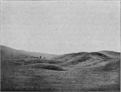
Fig. 230. - Glacial topography, eastern Washington. (U. S. G. S).
The conception of the cycle of topographical development is essential in geomorphological reasoning. Each cycle begins with the uplift of an area approximately at base level, the processes of denudation working with minimum efficiency and extreme slowness. The movement of upheaval revivifies the destructive agencies, and the work of carving out a surface of relief begins afresh, only to terminate, unless interrupted by renewed elevation, in once more base-levelling the region. A complete cycle is thus from base level back to base level, though, as it is a cycle, a beginning may be selected at any part of it.
The details of the cycle differ widely under different climatic conditions. If we take the successive stages as they are developed in a pluvial climate, with all basins filled, abundant rivers running to the sea, and all the snow of winter melting in summer, to constitute the normal cycle, we shall find that the arid cycle of desert climates deviates from the normal in very important ways.
The term age as applied to topographical features does not mean the length of time required for their formation, but merely the stage of development within the cycle which they have attained. The length of time required to reach a given stage of such development will vary greatly in different regions, in accordance with climatic conditions, the resistance of the rocks, their altitude above sea-level, and similar factors. An area of resistant rocks in an arid climate will be hardly at all affected in the time that a mass of soft rocks exposed to a heavy rainfall will be cut down to base-level.
It seldom, if ever, happens that the topographical development of a region proceeds uninterruptedly through the stages of youth, maturity, and old age. Oscillations of level introduce new conditions and cause the work of denudation to start afresh with renewed energy, or, if the movement be one of depression, it will check the work already in progress. The cycles of development are thus partial rather than complete, and a given region may display topographical forms dating from very different and widely separated cycles. The more resistant rocks retain the features acqured in an earlier cycle, while the weaker and more destructible rocks have already taken on the forms due to a later cycle. A landscape thus often includes features of different geological dates, and it is in the identification of these that the value of the physio graphical method to historical geology consists.
In the production of new topographical forms, old ones are more or less completely destroyed, and thus,- the farther back in time we go, the fewer subdivisions are recognizable, and only the outlines of the great cycles can be followed. Very ancient features would be quite obliterated in the successive cycles of development, were they not sometimes buried under the sediments of an encroaching sea. A subsequent reelevation of the area into land, and a stripping away of the covering of newer sediments by the agencies of denudation, will again bring to light the ancient land surface which had been buried for ages. An interesting example of this is presented by the Charnwood Forest in England, where an extremely ancient landscape is slowly coming to light, as the covering of soft rocks, which has so long preserved it, is removed by denudation.
In Part I we have already studied the agencies of denudation, but there we concerned ourselves principally with their modes of operation and their efficiency in destroying old rocks and in furnishing material for the construction of new. We have now to consider these agencies from a somewhat different point of view; to determine the characteristic forms of land sculpture which they produce at the various stages of their work.
Continue to:
My Books

