Chapter Three. Preparing To Hike
Description
This section is from the book "Time Out for Living", by Ernest DeAlton Partridge and Catherine Mooney. Also available from Amazon: Time Out for Living.
Chapter Three. Preparing To Hike
If you could follow a pair of experienced hikers along the trail, you would be surprised at the ease with which they meet every difficulty that arises. They have a solution to all ordinary problems, whether it be a sprained toe or an empty stomach. The skillful hiker plans his trip well. He knows what to anticipate and how to prepare for it. He never finds a hole in the tent that should have been repaired, or misses some important part of his food supply because it was not purchased. Furthermore, he does not find himself on a strange road with no idea where it leads. He carries a map of the country through which he hikes and he knows how to read it.
One of the first things to consider in planning a hike is the purpose. There are many different kinds of hikes: camera hikes, historical hikes along old roads, exploring hikes through new country following a good map, geological hikes, bird hikes, and many others. Sometimes it is fun to hike for the sheer joy of hiking. Rambling through the woods, over hill and dale, just for the fun of walking with a pack on your back and a song in your heart is great sport.
As a matter of fact, a real, honest-to-goodness hiker will walk every time he gets a chance. Even within the city limits there are many sights to be seen, just as in the small town many lanes and winding roads arc ready for exploration. If you want to become a real hiker learn to enjoy all kinds of walking. Take every possible opportunity to stretch your legs in the open air. You will find that the more you walk, the more you like it.
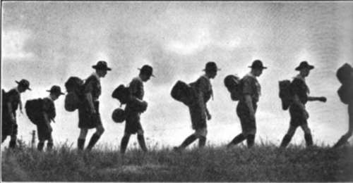
HIKERS ACROSS THE HORIZON.
Reading Maps. As the hiker becomes more and more familiar with trails near home, he will want to extend his explorations. In order to do this intelligently, it is necessary that some kind of map be consulted for information about trails and old roads. Sometimes hiking maps are available for the county or state. If not, the United States Geological Survey topographic maps are excellent for this purpose because of their accuracy and the amount of information they furnish. These maps can be secured for most of the country in sections showing approximately 220 square miles in each. When one learns to read these maps, they furnish a tremendous amount of information, such as the location of roads, paths, streams, and settlements; the location, size, and slope of hills; elevations above sea level, and so on.
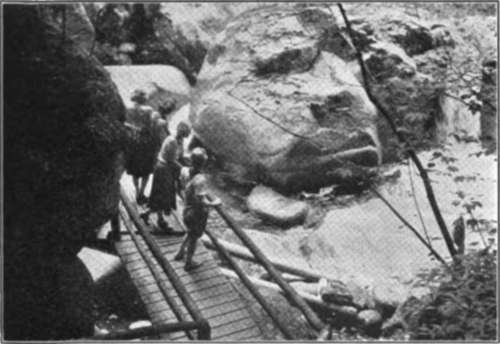
A Pause by a Mountain Stream.
It is a real adventure to secure one of these maps and then use it as a guide in exploring the surrounding country. When one becomes skillful in reading a topographic map, he can find his way about in strange country quite easily with the aid of a compass.
The topographic maps show elevation by means of contour lines. Contour lines might be described by comparing them with water marks made at different levels by a lake on a small island. If a deep lake, with an island in the center, were to be drained by letting the water down ten feet at a time and a line marked around the island at the water's edge each time, a series of lines would be made that showed the steepness and height of the sides of the island. On the steep side of the island the various levels of water would be quite close, that is, you would not need to travel far from the center of the island to drop ten feet. On the flat side of the island the various lines would be farther apart because one would need to go farther in order to drop ten feet. If one were looking down at the marks around the island from an airplane they would look like a topographic map.
Now, with this explanation, see if you can locate steep hills on the portion of a topographic map shown herewith. More complete explanations of the contour maps can be found in the references at the end of the chapter or on the back of one of the maps. One of the best ways of learning about them, however, is to ask someone who can read them to explain how they are read.
While some hikes need not be planned, for most trips of any length it is always wise to make certain that everything is in readiness. This foresight is especially necessary when the hike includes a meal or two on the trail or an overnight camp. Equipment should be checked carefully before leaving. Shoes may need oiling or repairing, cooking equipment should be clean and ready for use, shelters may have holes that need repairing. Flashlight batteries become stale and useless; they should be tested. If you allow yourself plenty of time to take care of these things before you start on the hike, your chances of enjoyment are much better.
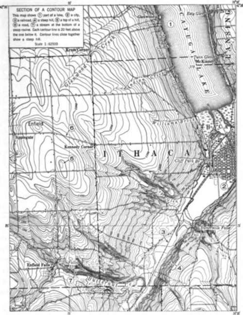
Can you read this section of a topographic map?
Here are some reasonable and comfortable hiking outfits for summer wear.
Continue to:
My Books

